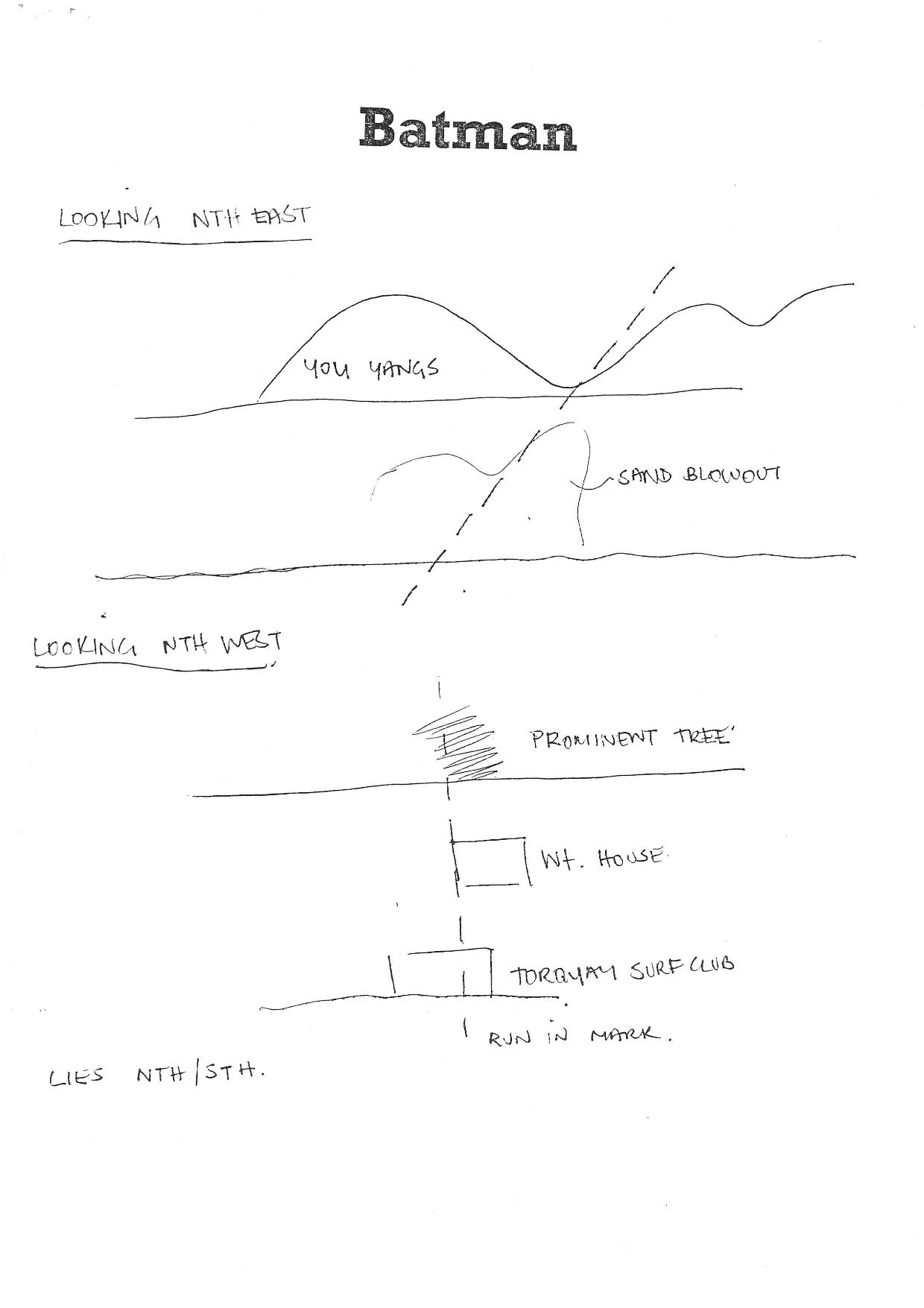
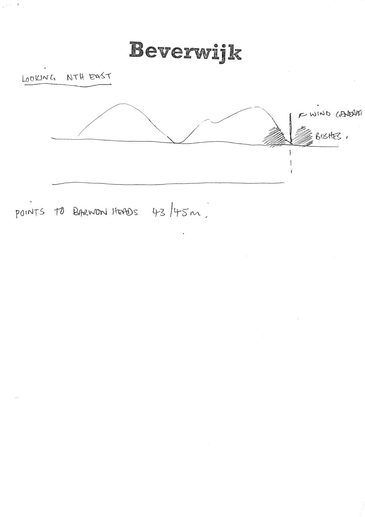
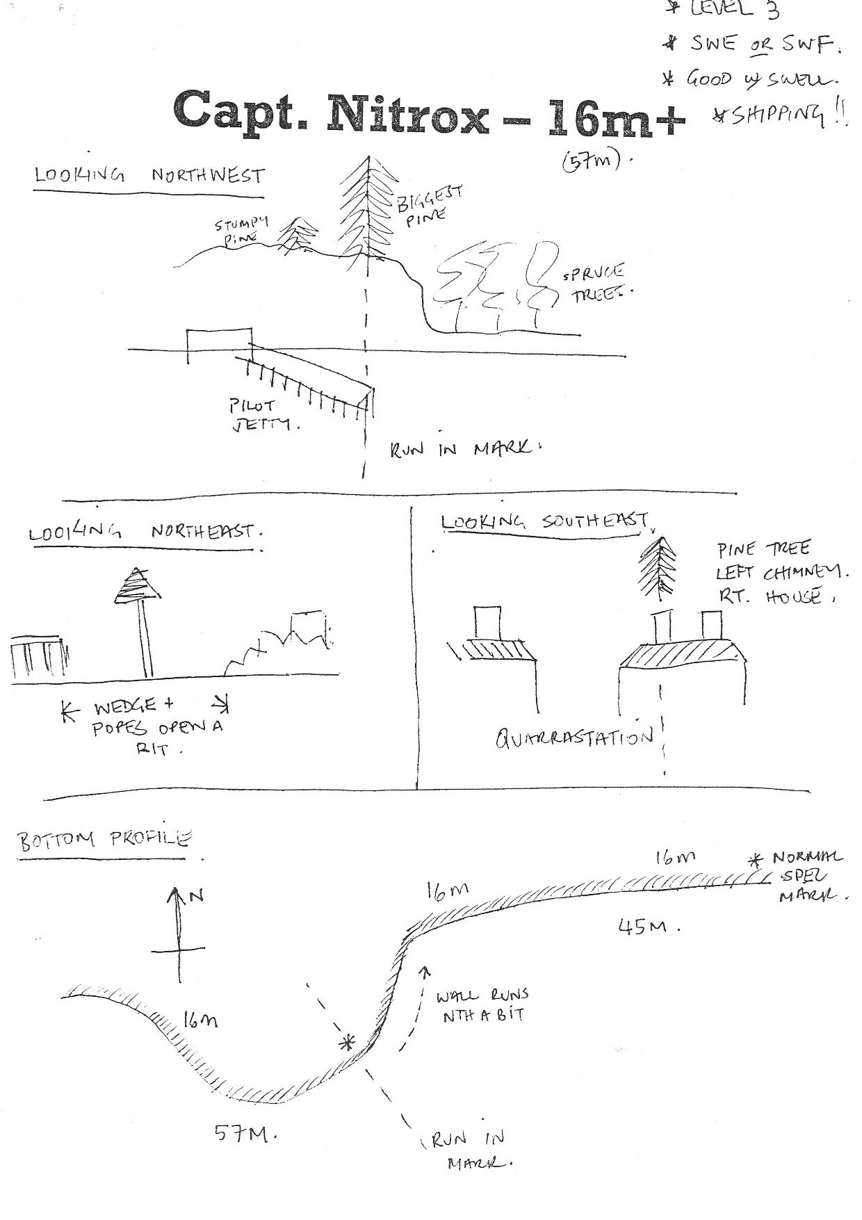
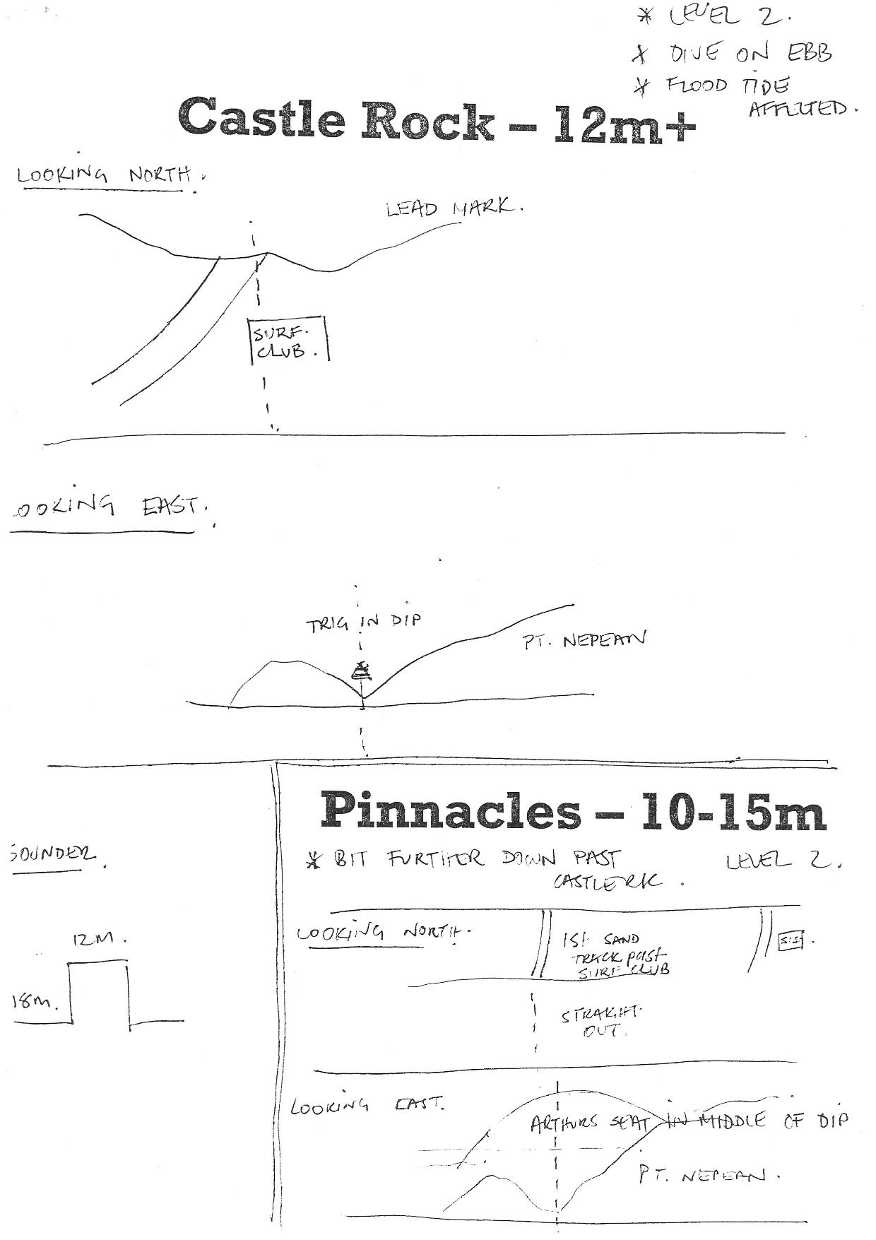
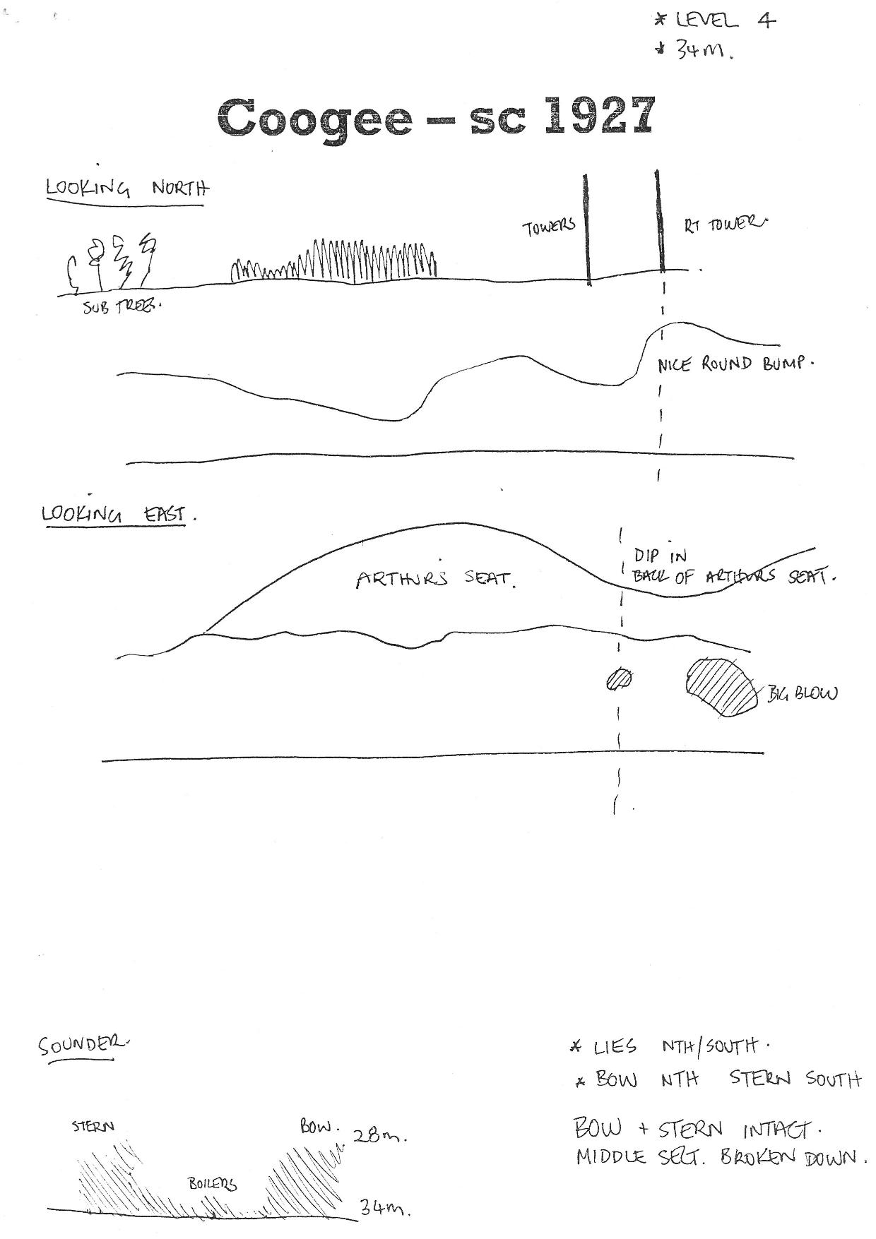
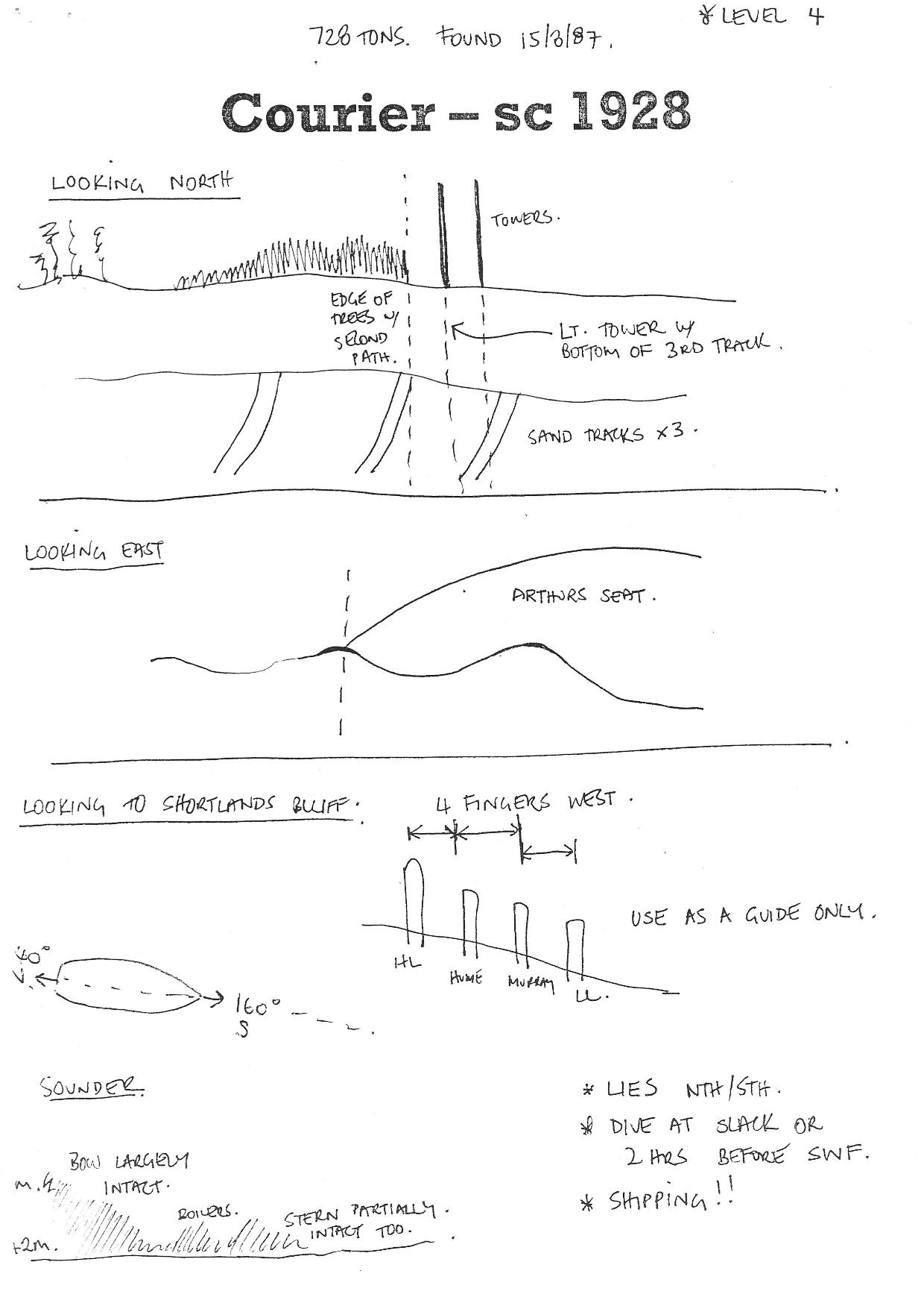
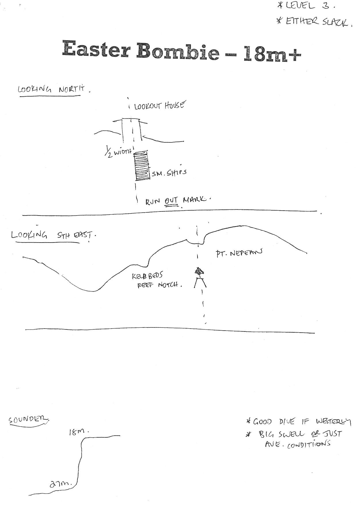
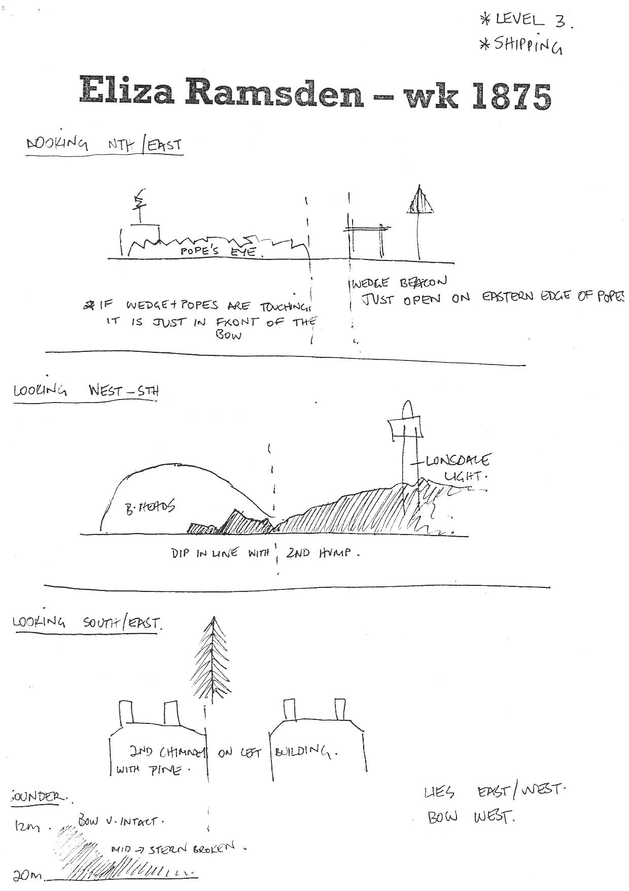
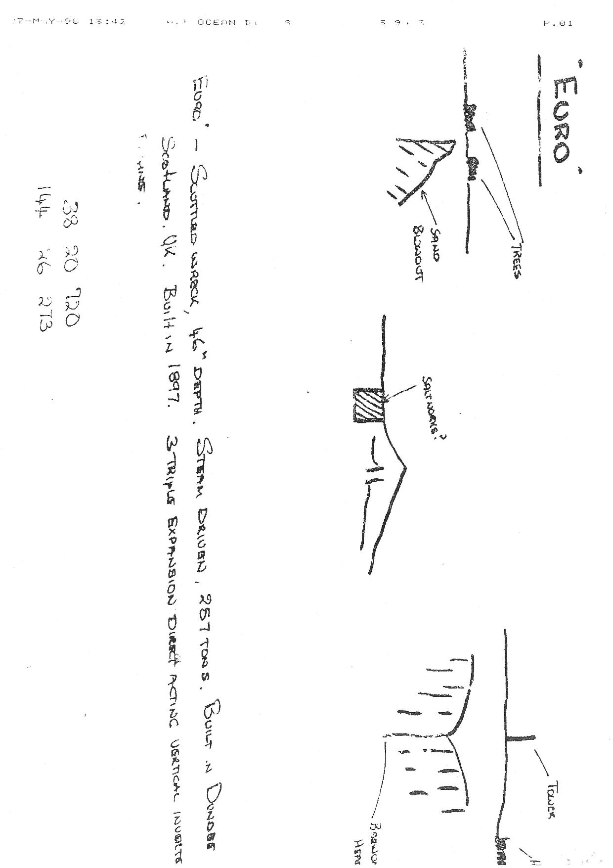
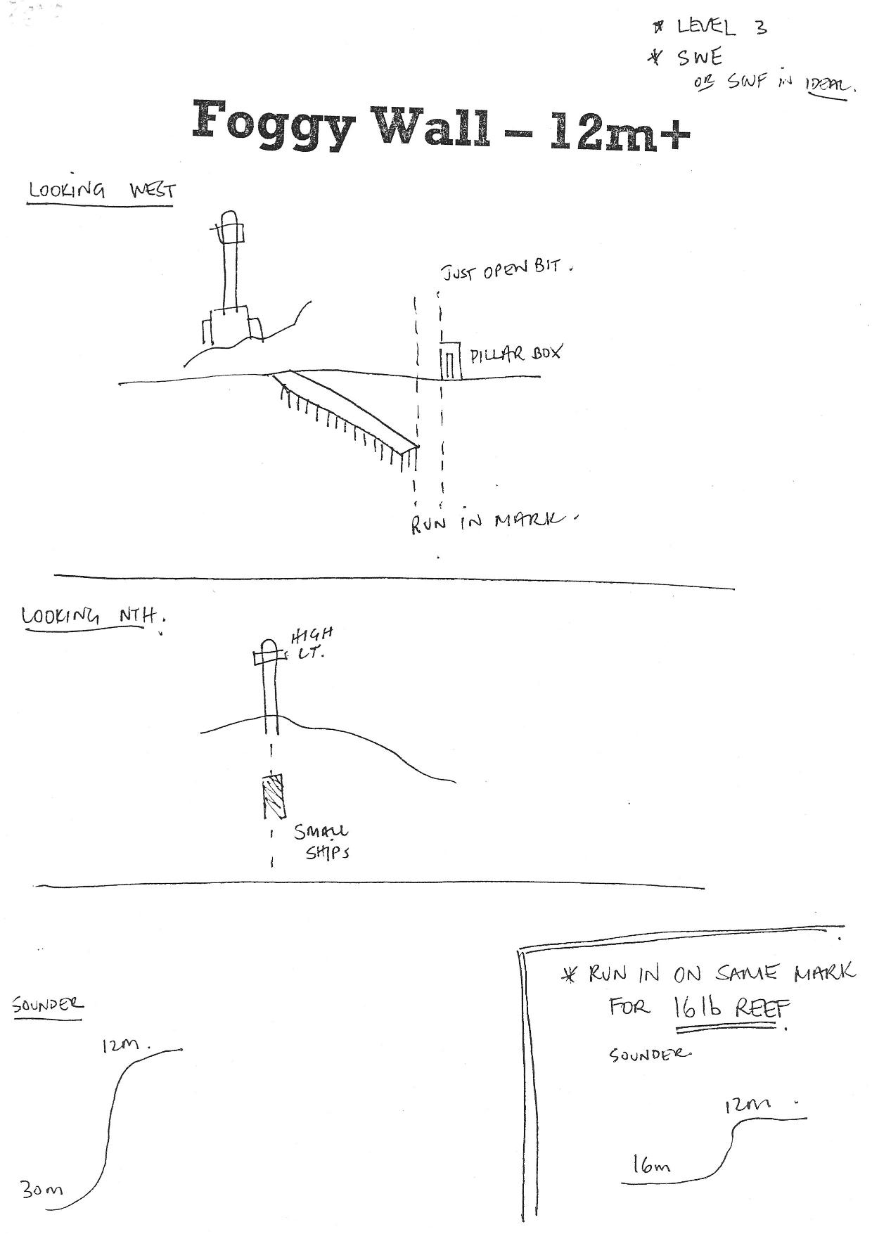
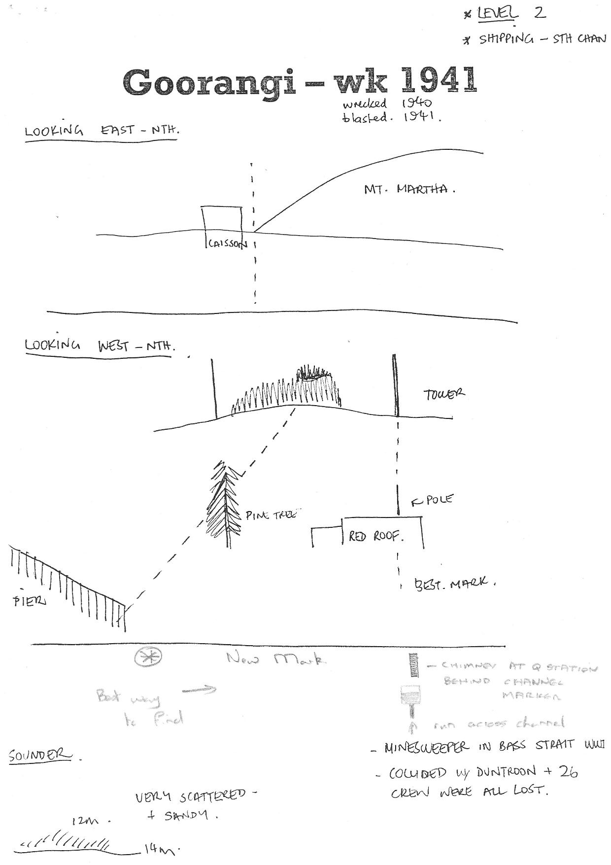
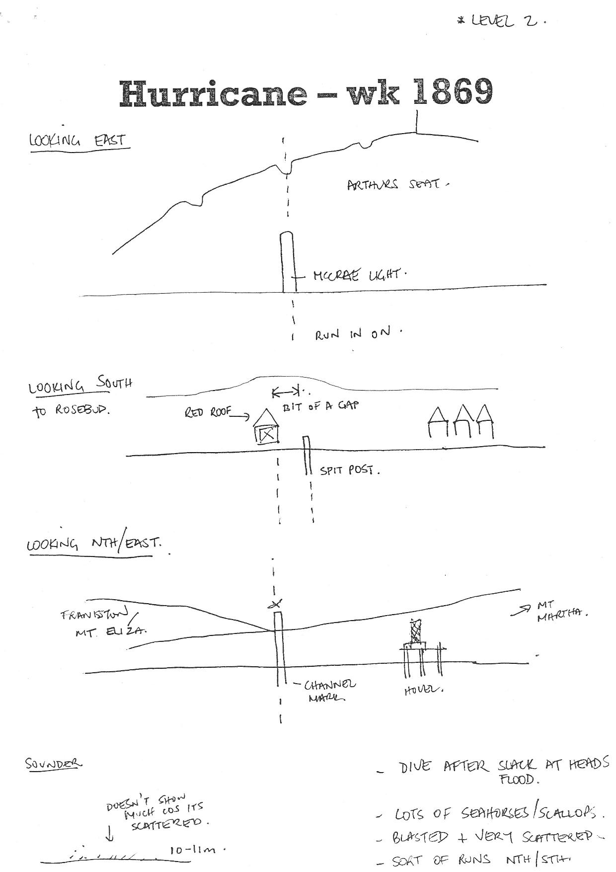
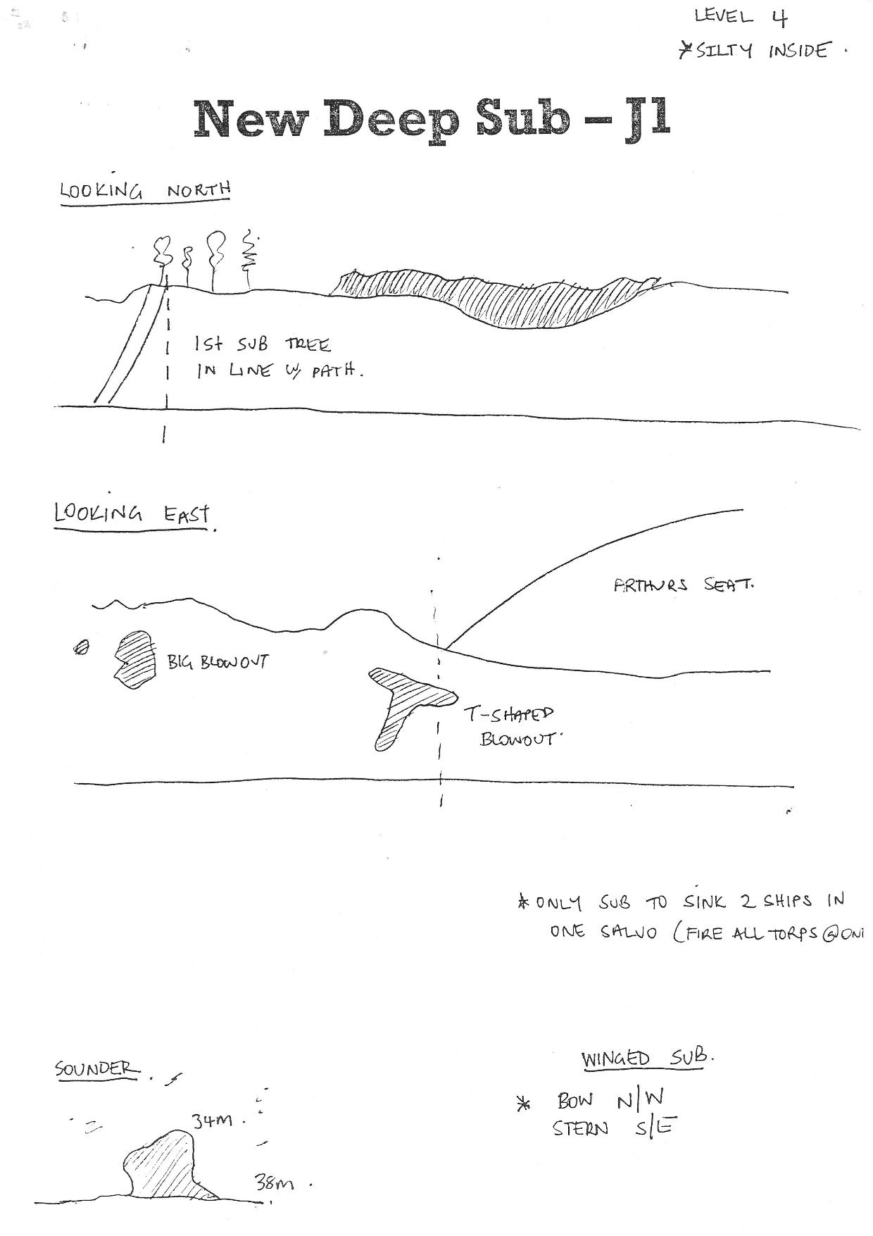
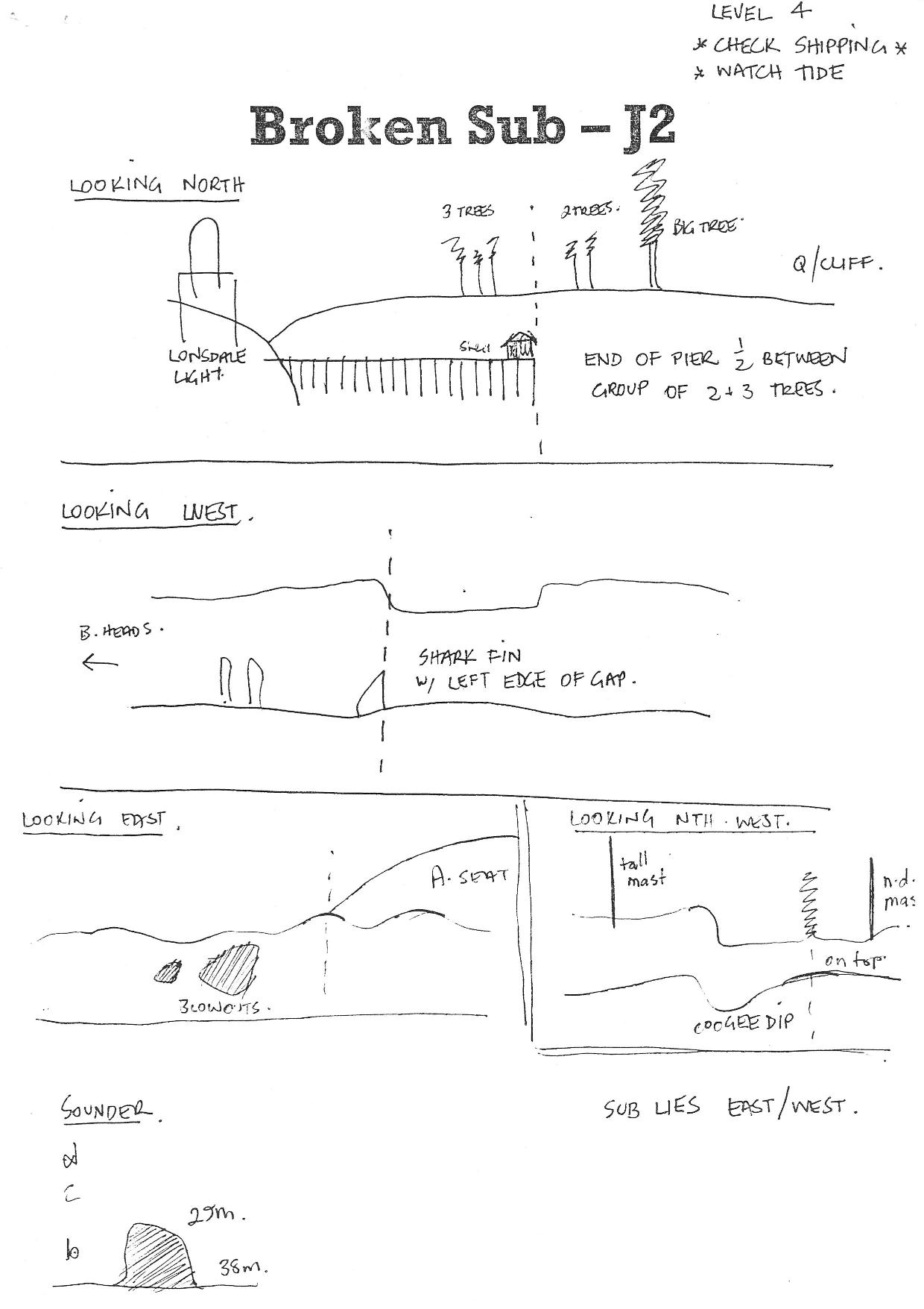
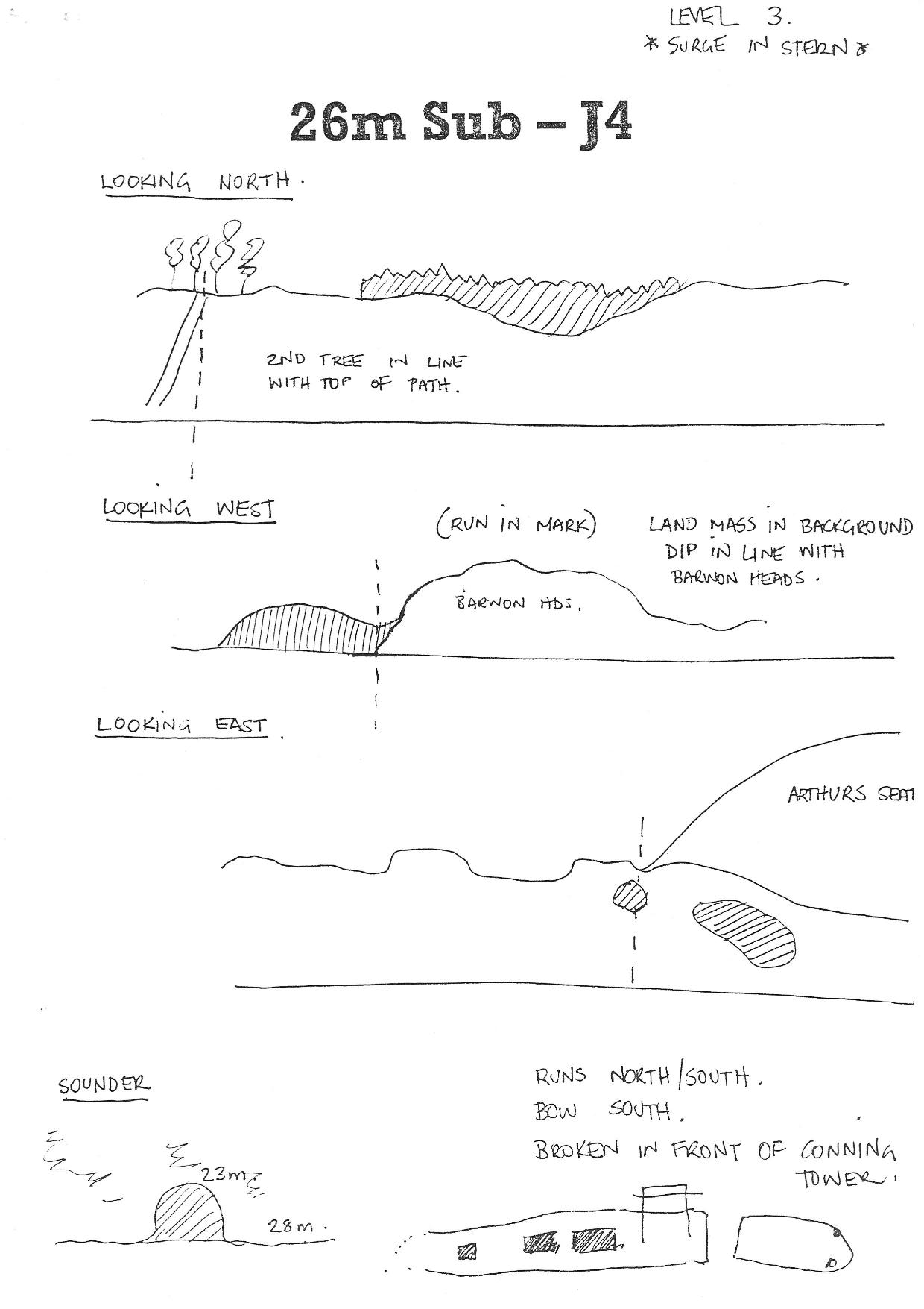
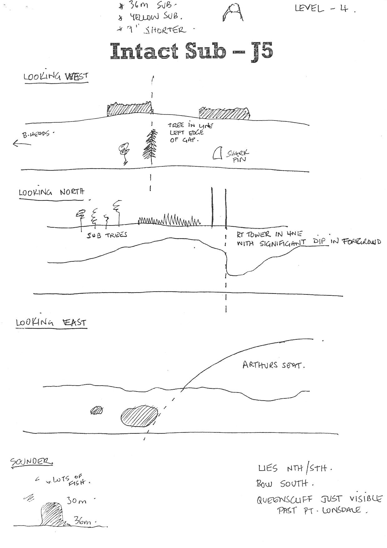
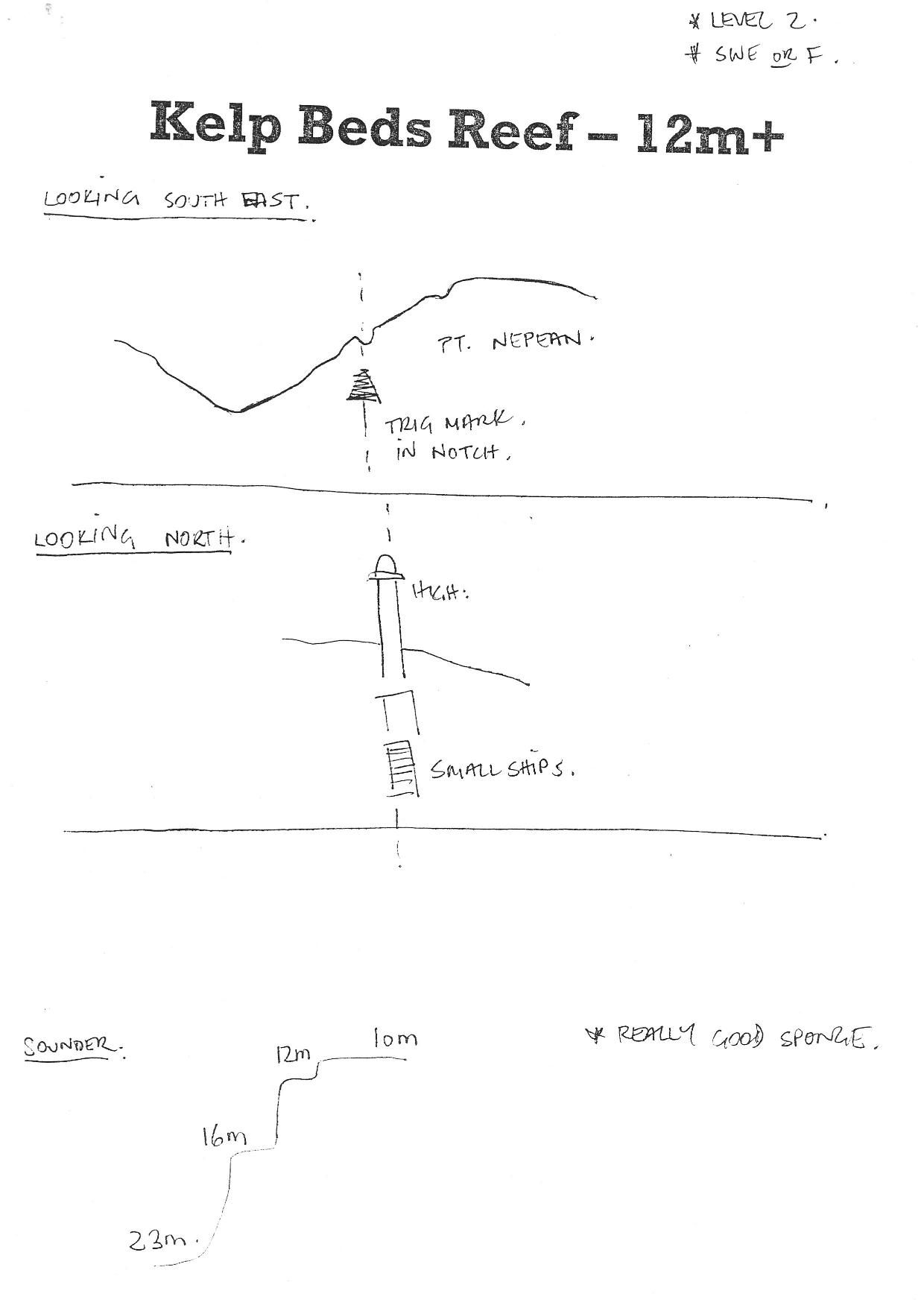
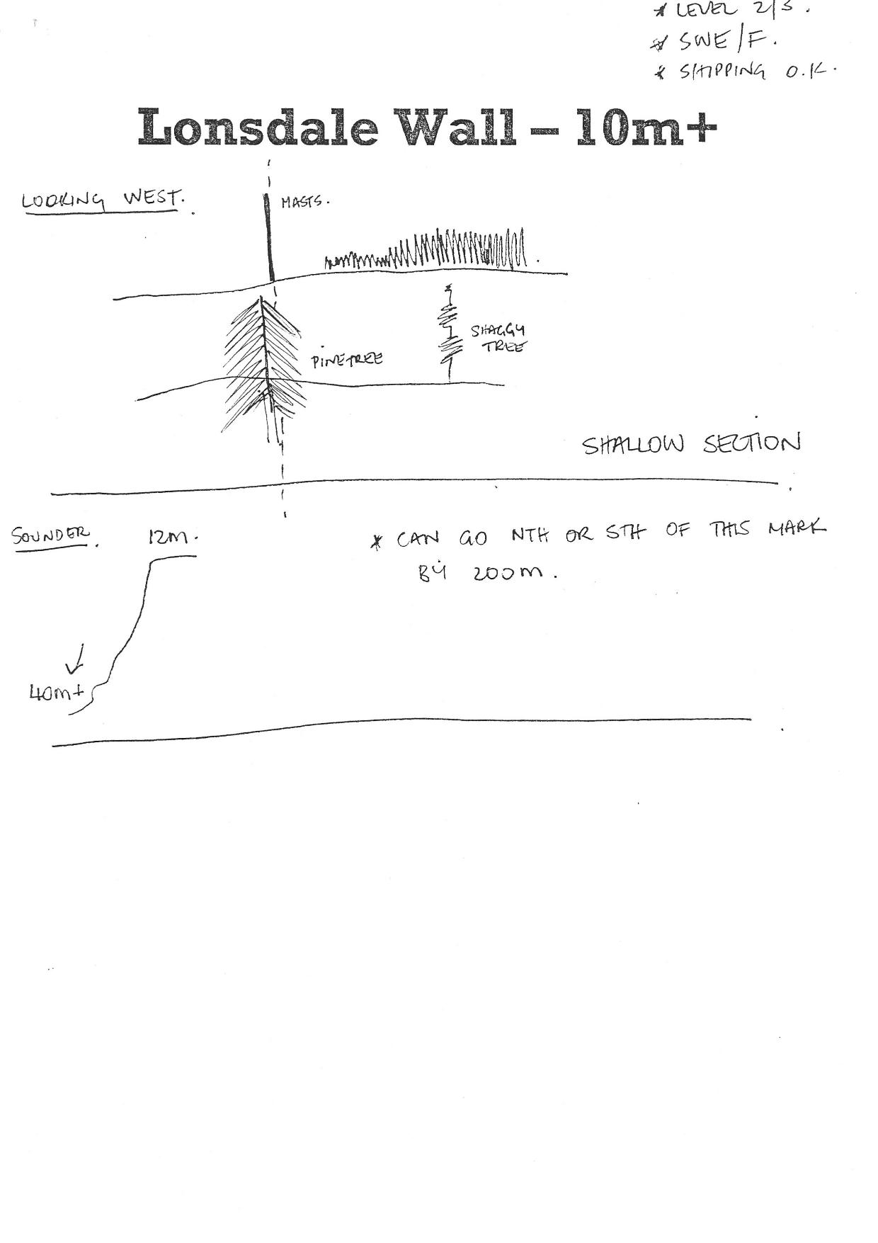
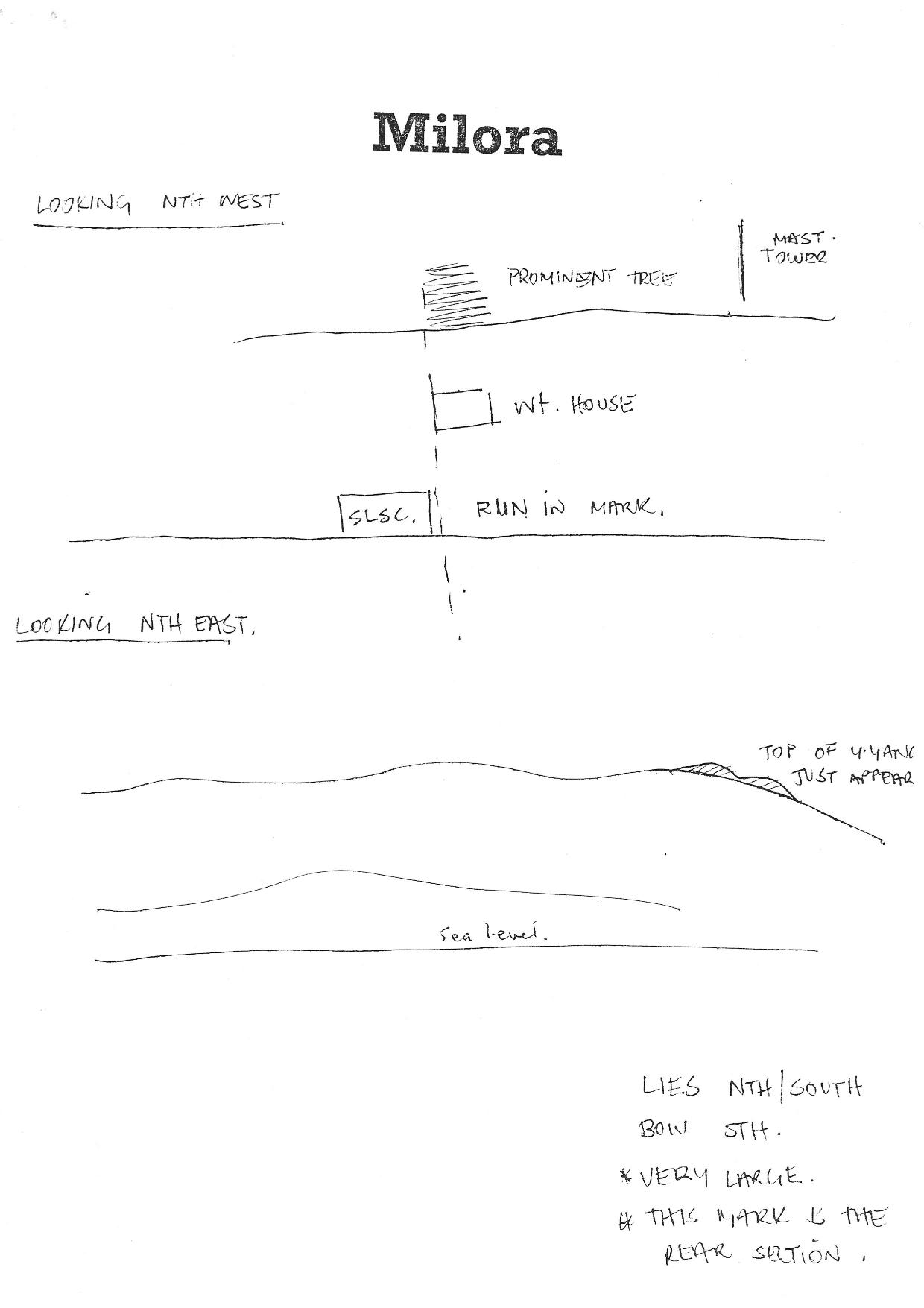
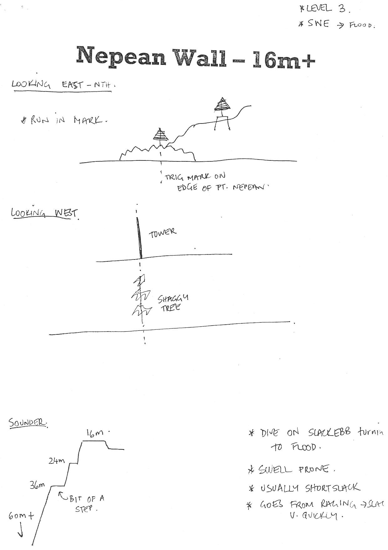
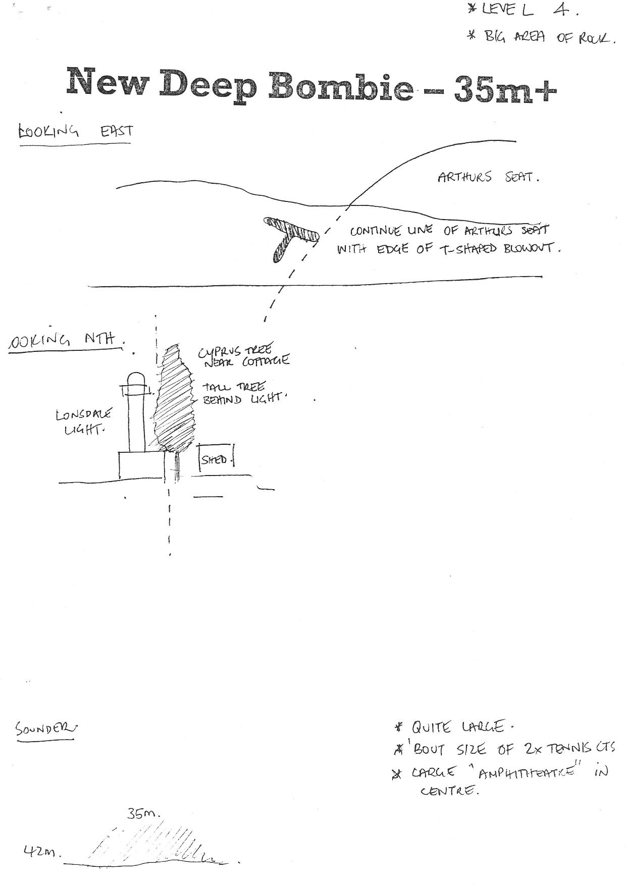
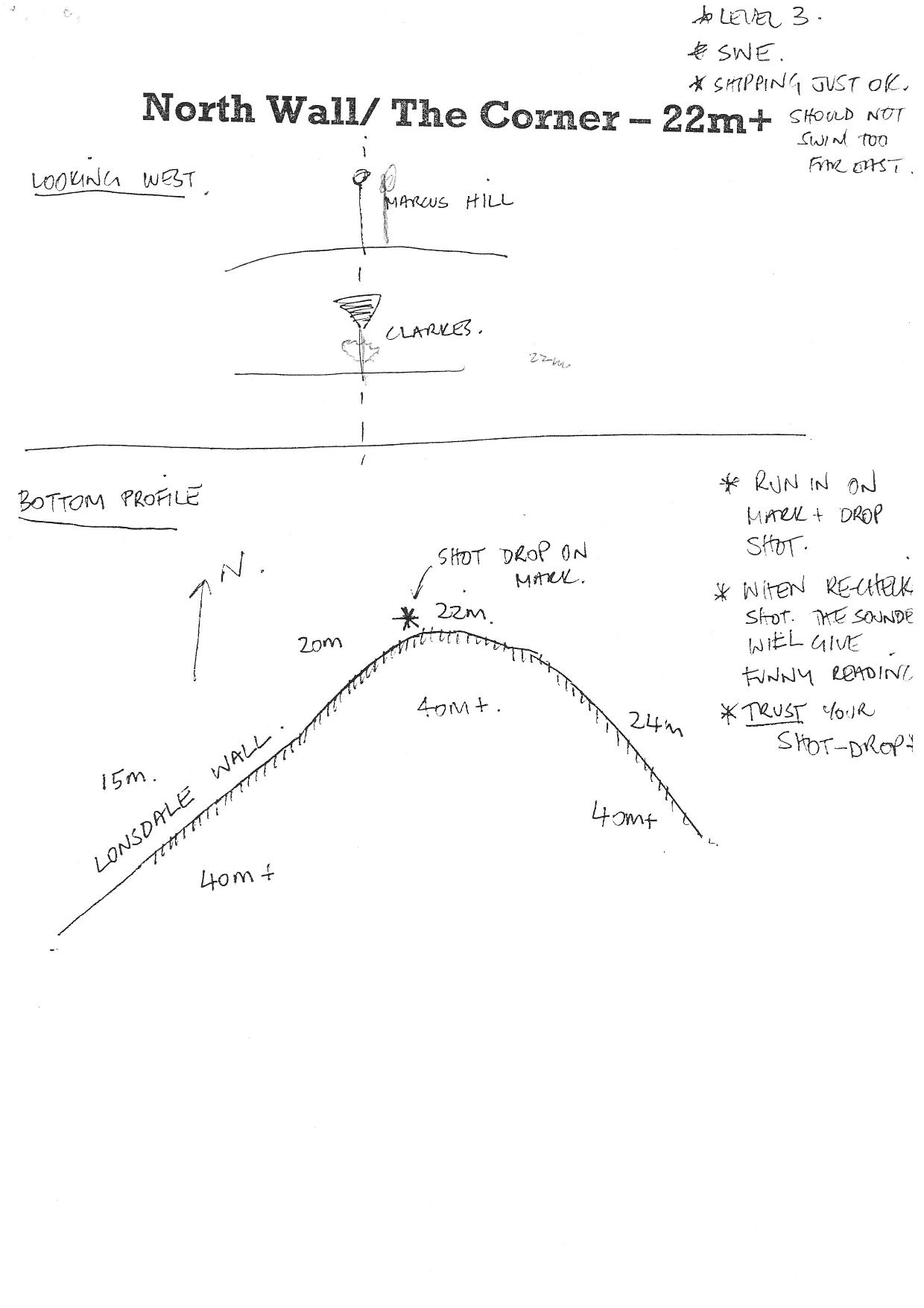
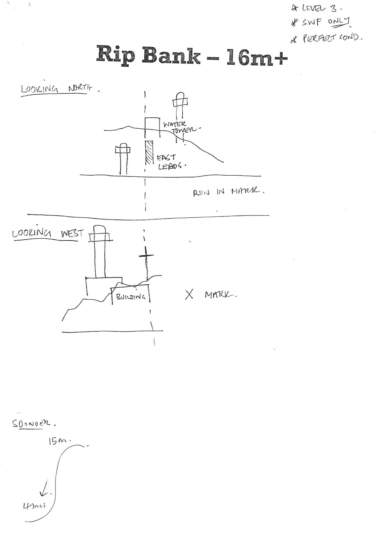
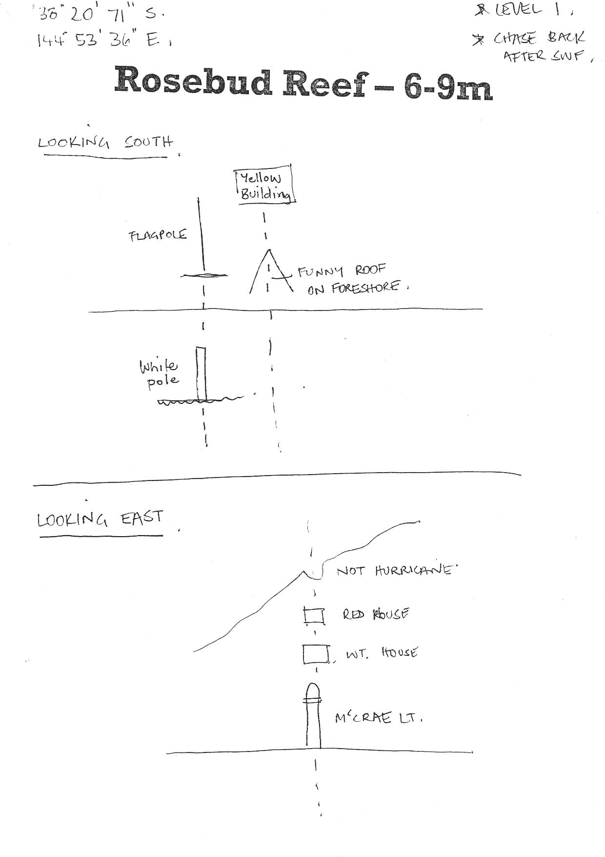
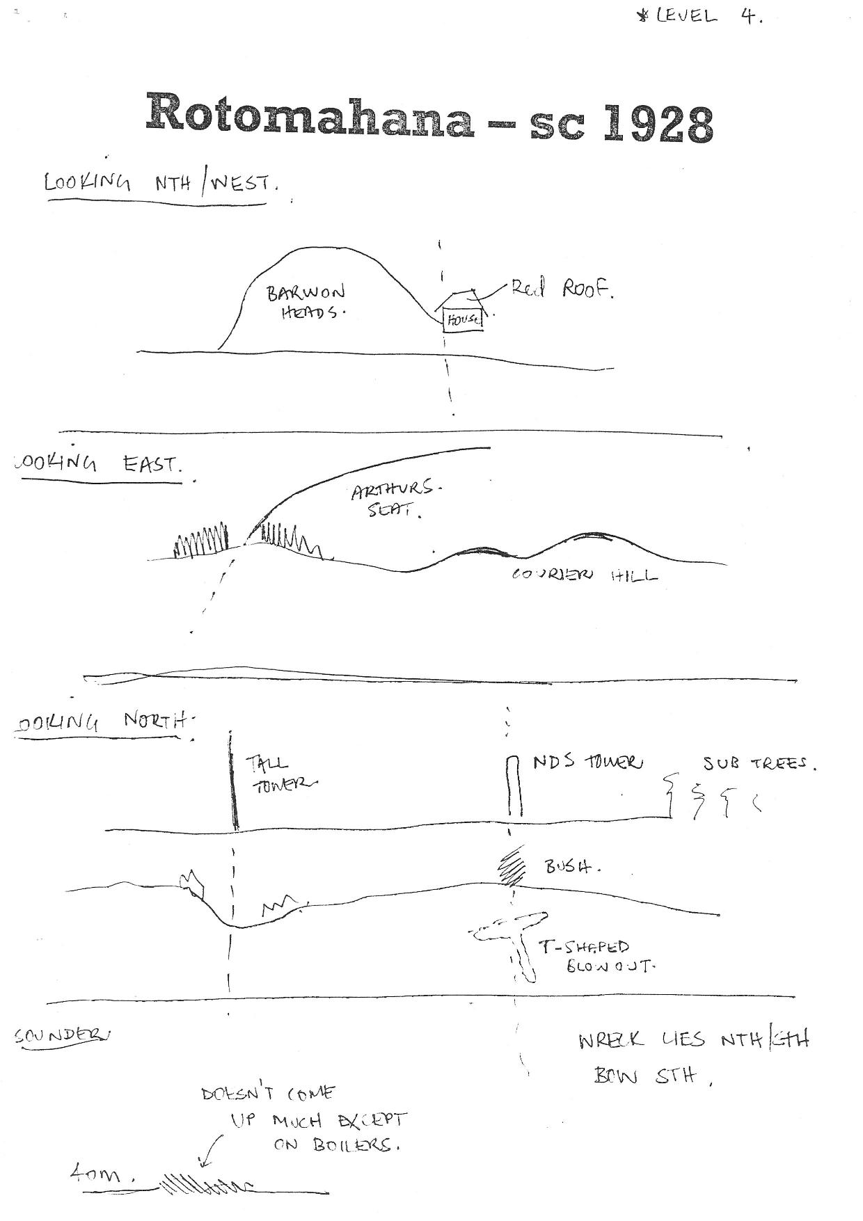
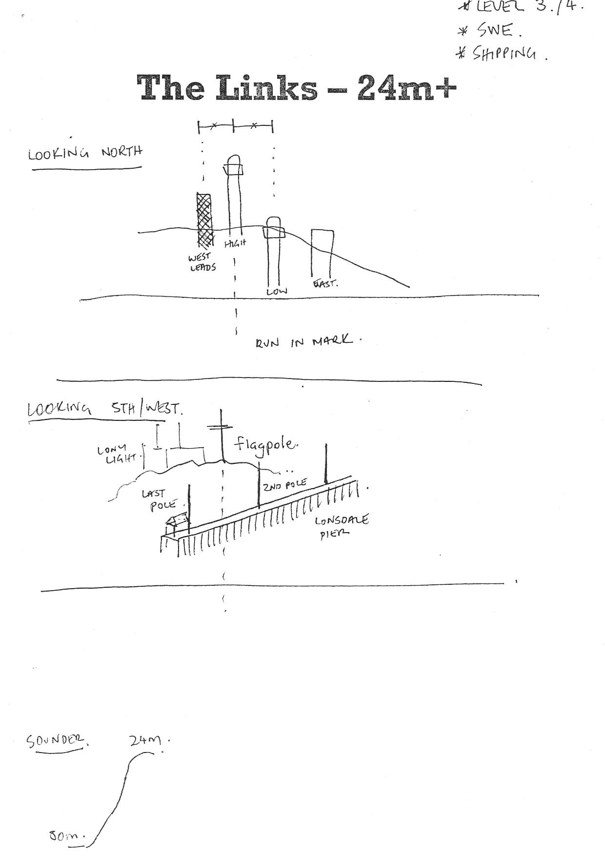
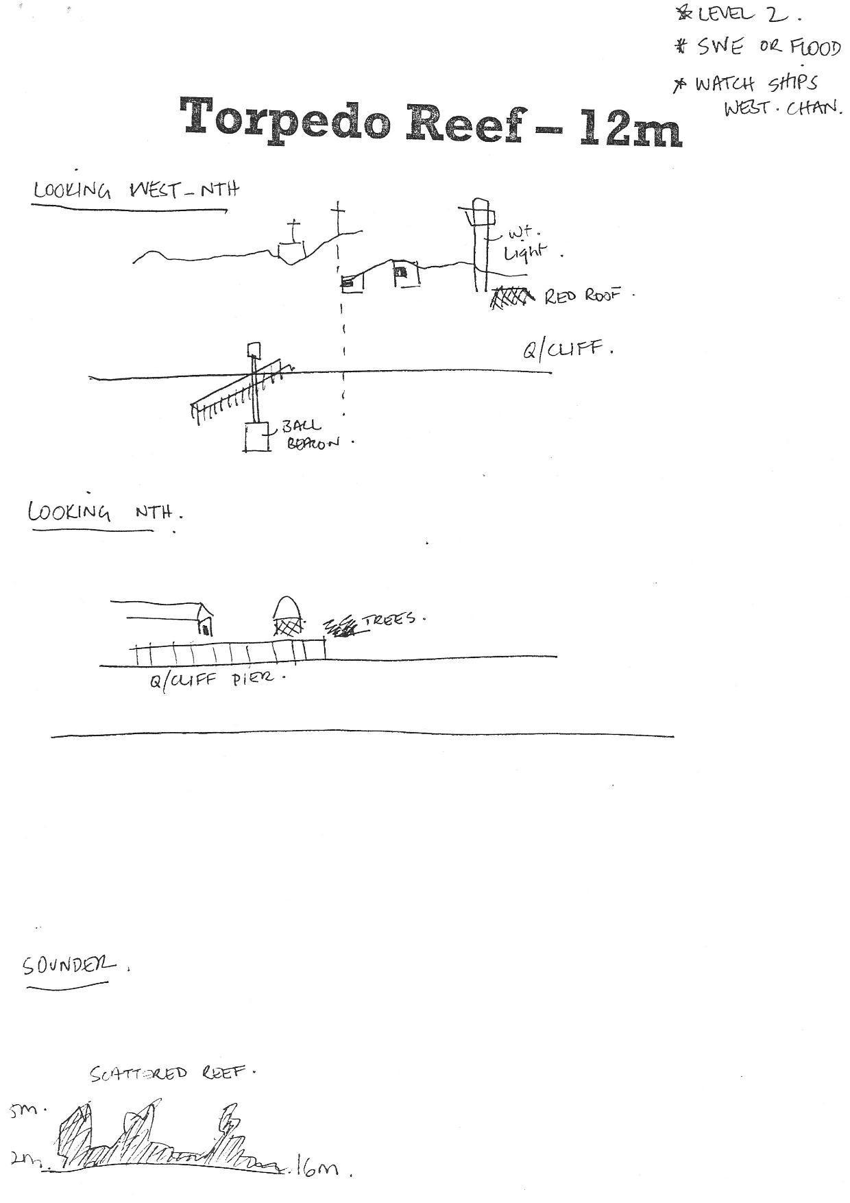
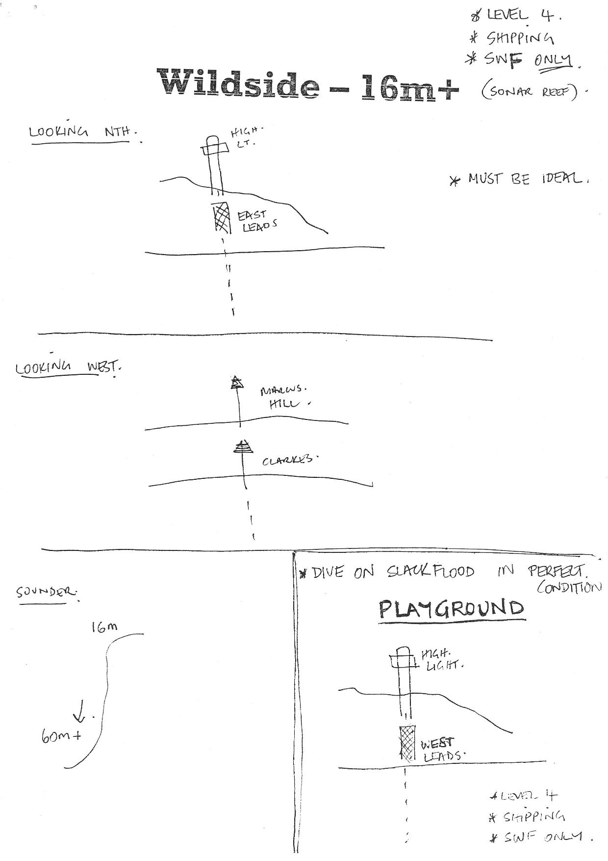
Have you ever wondered how dive sites were located in the days before GPS? Back then VSAG boat skippers had to be skilled in the use of visible transits - this means looking at the shore, finding two or more landmarks that line up but are at different distances from you. We still use this technique to navigate a course today. Landmarks could be almost anything including hills, valleys, trees, chimneys, houses, buoys, piers. Great examples of this are lining up the lights at Queenscliff to transit the heads in the small ships channel or lining up the two markers at Newhaven Yacht club to enter Newhaven boat ramp.
When you have visual transits in two different directions you are able to find the spot where two visual transits intersect i.e a specific spot on the ocean. Back in the day when a new dive site was found the visual transits had to be created and recorded for future use. Here are a selection of these from our club archive. Given the work involved in creating them we wanted to preserve them but their use today would be difficult as many landmarks have disappeared or changed over the years.